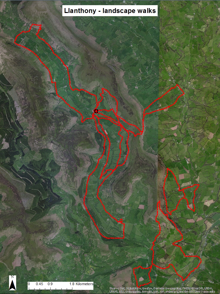
Composite map of the
landscape walk routes in the Llanthony Priory case study (Source: map drawn in ArcGIS using ArcGIS World
Imagery basemap).
A note here on the experiential landscape
walks that I am undertaking across the three case study areas on which my PhD research is focussed, a core element in an interdisciplinary approach: blending the solid of landscape history with the drift of landscape perception.
One key purpose is to bridge the traditional fieldwork focus on macro-level reconnaissance across relatively large areas on the one hand and smaller-scale targeting of specific sites and features through survey, field walking, test pitting and so on on the other. The walks aim to fulfil a complementary and linking middle ground that also provides additional evidence and value. More fundamentally, actually walking and moving through the landscape on foot, experiencing and investigating on the ground, helps to provide a more nuanced, fleshed-out and three-dimensional feeling to supplement important but formulaic desk-based study focused on academic reading and ‘birds eye’ views from aerial photographs, satellite imagery and maps and so forth. This is deep topography in practice: a deepening understanding of landscape history allied to a deeper perceptual viewpoint. Getting to know a landscape, its biography through walking.
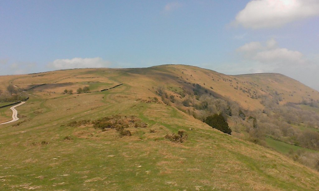
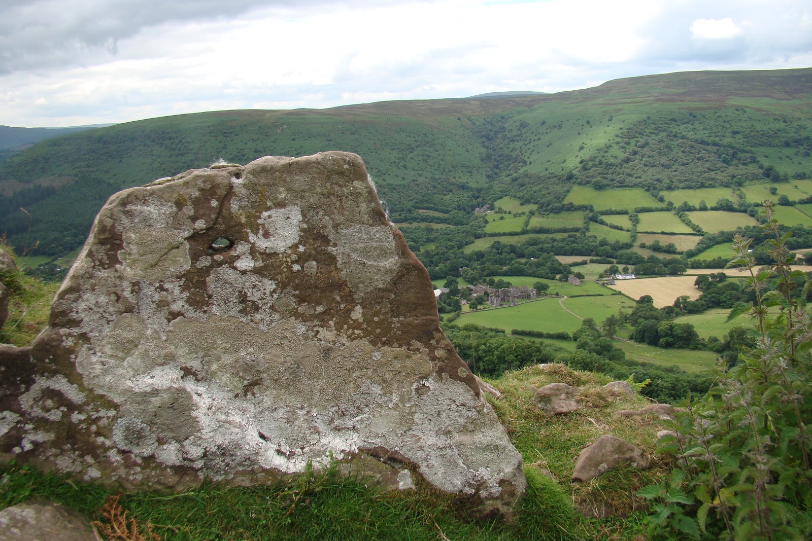
The old roadway to Llanthony Priory from Longtown and its Herefordshire estates, now disused; investigated on the Llanthony to Longtown landscape walk.
I have appropriated 'deep topography' here from Nick Papadimitriou's description of his 'conscious walking' through the fringes and suburbs of North London, most expansively articulated in his book Scarp: In Search of London's Outer Limits (2013). This terminology could also be used to describe the work of outlier geographers, largely operating outside of the academic arena, such as Patrick Keiller (The View from the Train: Cities and Other Landscapes, 2013), Tim Robinson (Stones of Aran: Pilgrimage, 1990) and Will Self (Psychogeography, 2007). All exponents of a more nuanced counterpart to the now perhaps over-cooked concept of 'psycho-geography', less shackled to its conceptual and urban prescriptions. Self has described deep topography as ‘minutely detailed, multi-level examinations of select locales that impact upon the writer’s own microscopic inner-eye’, combining ecology, history, poetry and sociology; or in Nick Papadimitrou’s own terms ‘an acknowledgement of the magnitude of response to landscape.’ A mention here of another related concept, phenomenology, which this research also aims to integrate. A phenomenological approach views the environment as more than just a
passive backdrop or external object of the spectator’s gaze; providing a
challenge to more traditional ideas of landscape as simply a way of seeing the world
or a repository of empirical material data. Ideas taken forward most notably in relation to landscape by archaeologist Christopher Tilley (A Phenomenology of Landscape: Places, Paths and Monuments, 1994) and anthropologist and cultural geographer Tim Ingold (Imagining Landscapes, Past, Present and Future, with Monica Janowski, 2012).
Although psycho-geographical texts and practice have attracted academic interest in recent years, this has tended to be within the confines of cultural geography and literary studies and focused on the urban experience, whilst the extensive archaeological practice of phenomenology has largely been limited to the study of prehistoric landscapes. As Papadimitriou’s ventures into deep topography throughout the Middlesex-Hertfordshire boundary lands and W.G. Sebald’s long existential walk along the East Anglian coast (The Rings of Saturn, 1995) demonstrate, any landscape can in principle be opened up to what Iain Sinclair has described as: ‘psycho-geography lite. It was a long way from the Situationists but it suited the English sentiment about walking, deep-topography, historical scavenging.’ This is the context for my tramps through the countryside of the southern Welsh Marches, looking for the liminal topographical ghosts of monasticism.
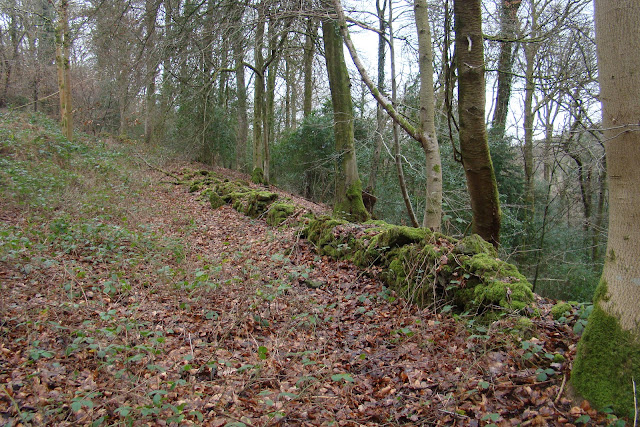
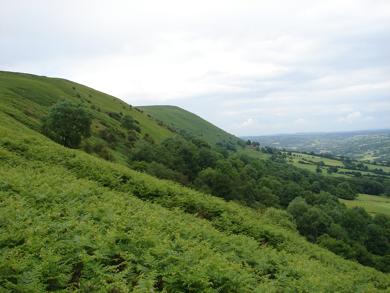
An old wall in the woods above the Angidy Brook, possibly a boundary of the 'lost' Tintern abbey grange of Secular Firmary; investigated on the Porthcasseg landscape walk.
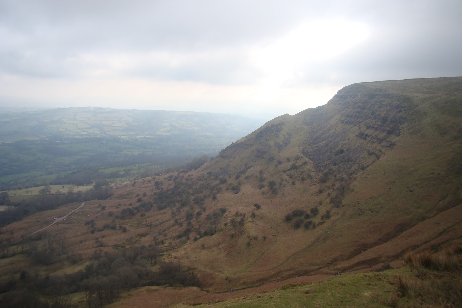
A series of walks is being undertaken in each case study area focussed on particular themes, features and objectives identified through initial desk-based analysis, but with scope to venture ‘off-piste’ when in the field (composite maps of the walks taken so far in the Llanthony and Tintern case studies are provided here). Through a mix of observation, photography and note-taking places that can be easily overlooked, neglected or invisible to the casual eye are investigated and recorded. The footpaths, lanes and off-the-beaten-track routes followed form a sort of outdoor laboratory for the crystallizing of thoughts, ideas and connections, found evidence of the medieval and historic landscape and a wider appreciation of the geography of, and feeling for, the landscape as it is passed through. A mental map taken back to enrich work at lap-top and desk.
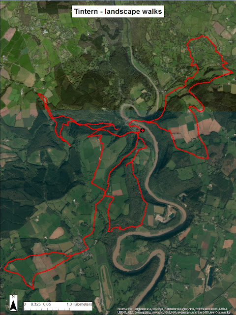
Composite map of the
landscape walk routes in the Tintern Abbey case study (Source: map drawn in ArcGIS using ArcGIS World
Imagery basemap).
The output from the walks is a set of commentaries and photographs of the landscapes encountered both from a physical and perceptual perspective, with an accompanying map of the route. As well as informing the main narrative these notes, which will be presented in a standard format as an online resource alongside the main Thesis (see example screenshot extract below), are intended as a more in-depth supplement to the main text. The discussion section of the Thesis will also critically evaluate what worked well and less well in integrating this approach with more conventional landscape archaeology and history research tools.
Extract from Cwmyoy South landscape walk notes.
Finally, back to Nick Papadimitriou. In an interview on the subject of his deep topography practice at the London Short Film Festival, he outlined six tips for deep topography walking. The approach adopted for my research does not necessarily stick to all of these principles and aims to demonstrate a more expansive fusion of such metaphysical exploration with other approaches, but they provide a useful starting point and stimulus:
- Go walking. Stay away from bright lights.
- Explore second hand bookshops. Buy books on topography – on areas, regions, counties. Study them. Then walk around and see whether you can make sense of the present landscape in relation to the past. This way you’ll get more tension and depth in your engagement with the landscape.
- Go out on your own without any maps and without a digital camera. Digital cameras are the death of the imagination.
- Go in any direction that suits you. Go in unfamiliar directions. Go in familiar directions and try and see things in a new way.
- Develop a sense of contours. They tell you a lot about the tensions and releases of the landscape and the way the ancillary aspects if the landscape (such as sewage and drainage systems) are organised. It will build up your sense of place.
- Develop a poetry out of the commonplace. The two aren’t opposites. The inexplicable and the obvious reside alongside each other.
Nick expands on his approach in John Roger's documentary The London Perambulator: Afoot in London's Edgelands (2009):